
Video Forecast
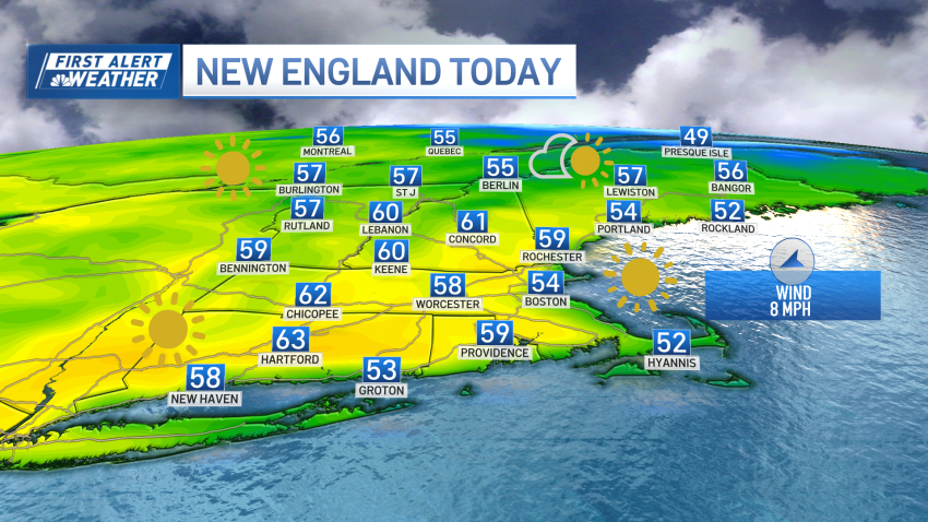
Weekend forecast: It's going to be rather splendid in Boston
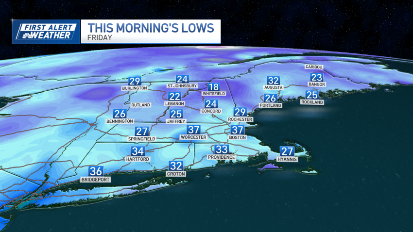
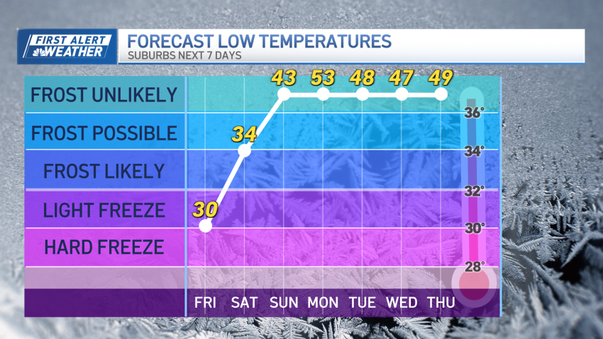
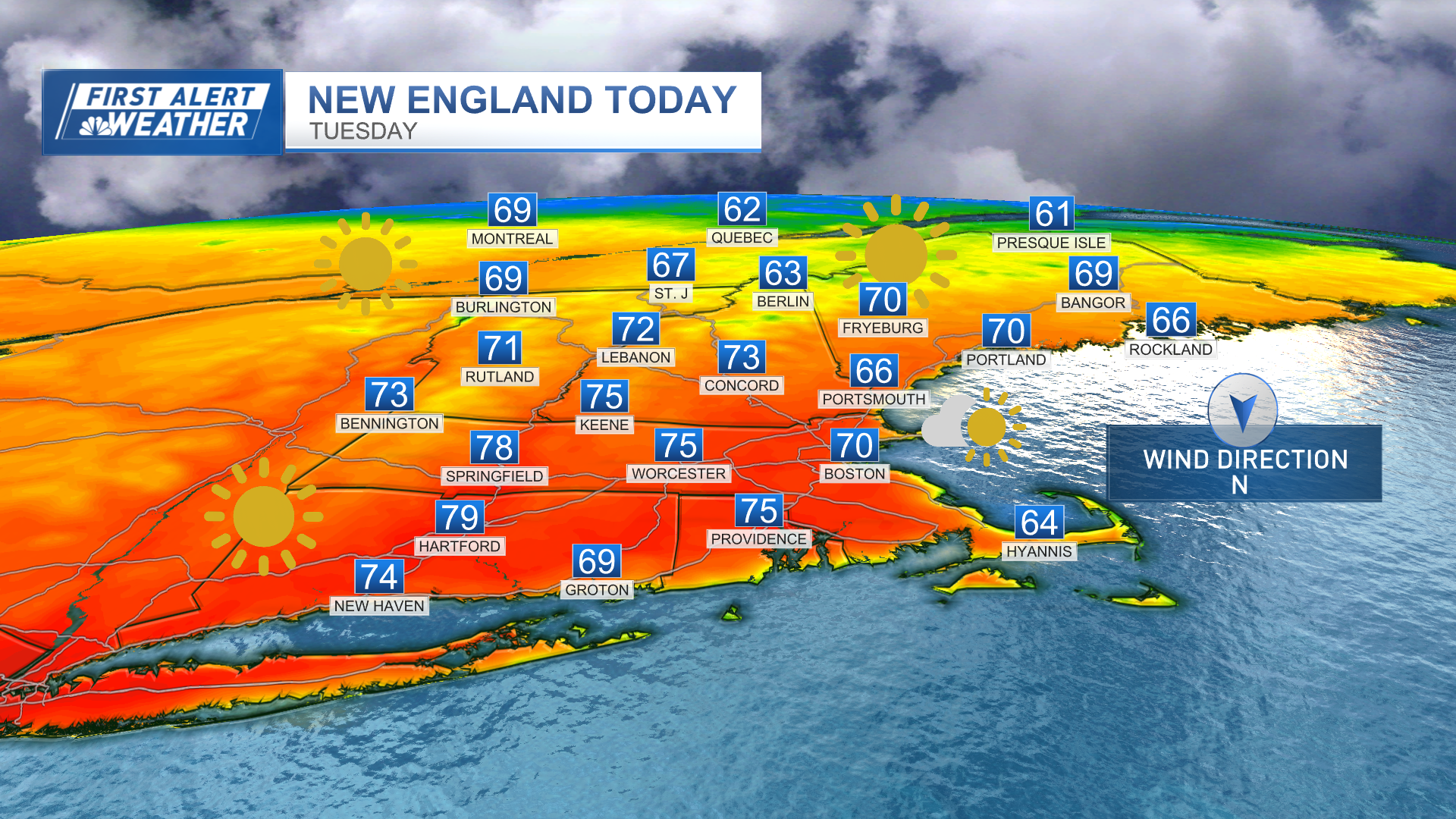
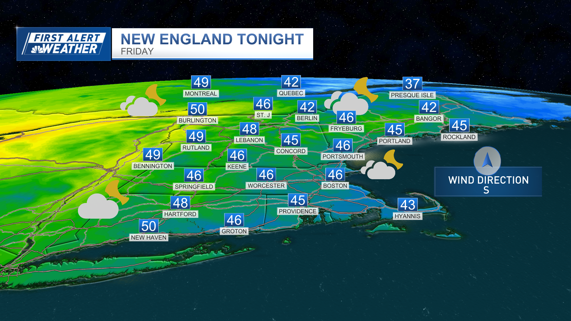
Friday evening: Clear, temps in the 50s. Overnight Friday night: Clear skies. Lows around 40. Saturday: Sunny. Winds: E: 6-10mph. Highs in the low 60s. Sunday: Scattered morning rain, then sun. Highs in the upper 60s.