
Cold temperatures are on hiatus for a bit as we undergo a small warmup. Sun combines with milder air to boost us into the mid-40s Thursday afternoon ahead of a quick-moving weather system that arrives Thursday night and Friday.
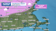
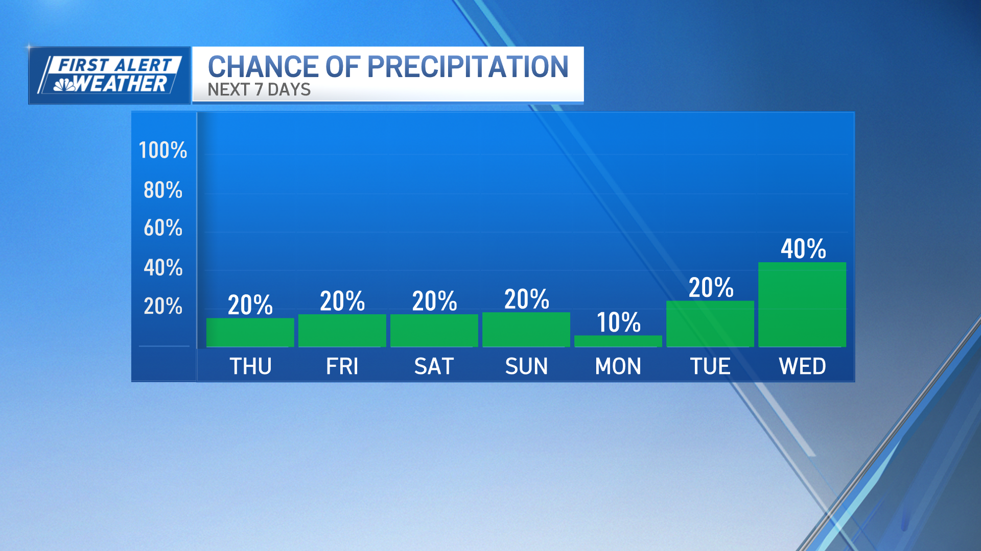
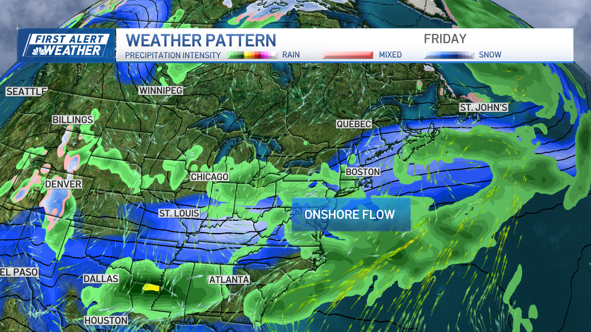
Although we're stressing the warmup, there is still enough cold air around for us to see some wet snow and mix as the precipitation sets in Thursday night. Minor accumulations (less than an inch) are possible in northern Massachusetts and southern New Hampshire.
Get New England news, weather forecasts and entertainment stories to your inbox. Sign up for NECN newsletters.
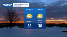
Otherwise, we're "treated" to a wet Friday forecast. Highs still manage to make the upper 40s in most spots. Colder air waits in the wings for Saturday, however. It'll be driven into the region by a gusty northwest wind behind our departing storm. Sunday starts numbing, then recovers to the upper 30s under plenty of sun (like Saturday). So, at least we have that.
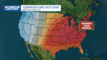
Next week, we're gearing up for a major warmup. Will this put the knife in the back of winter? Not ready to make bold statements like that yet, but we're certainly not on winter storm watch going into March. It's pretty telling, however, that even after our foray into 60 or so Wednesday, the "cooldown" will only be in the 40s late next week.
Weather Stories
Enjoy the finish to the workweek!
