
There were severe storms across New England Friday afternoon, leaving tens of thousands of people were without power.
Flash flood warnings and severe thunderstorm warnings were in effect in much of New England throughout the later part of Friday, but they have since expired.
See all severe weather warnings in your area here, and explore interactive radar below.
Get New England news, weather forecasts and entertainment stories to your inbox. Sign up for NECN newsletters.
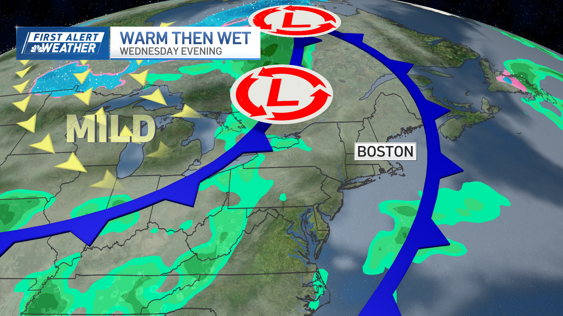
The weather forecast for southern New England was bringing a mix of hot and humid conditions, scattered severe thunderstorms and the looming threat of Hurricane Lee.
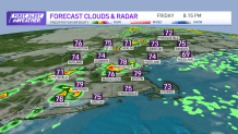
After a somewhat foggy start particularly in southeastern Massachusetts and Rhode Island, cloud cover remained decent for the south that gradually cleared inland, leading to partly sunny skies.
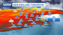
Despite somewhat cooler temperatures, expect widespread mid to upper 80s across southern New England with dew points in the low to mid 70s, resulting in heat indices well into the 90s. A heat advisory has been extended for the eastern coast due to consecutive days of high heat indices.
Additionally, we’ll want to keep an eye on the sky again this afternoon, especially west of I-495, as severe thunderstorms are possible, with the greatest threat north and west of Worcester. The main hazards include damaging wind gusts, heavy rain and the potential for hail. Showers and thunderstorms will diminish overnight, but some lingering showers are possible with shortening coverage.
Fog and low stratus clouds will develop across most of southern New England, leading to another muggy evening with lows around 70 degrees. Stay weather-aware as hot and humid conditions persist, and the threat of severe thunderstorms looms.
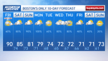
Similar weather is expected this Saturday with persistent cloud cover, which should keep slightly cooler temperatures in the low to mid-80s. High dew points, however, should lead to heat indices below 90 degrees. Scattered showers and thunderstorms are likely across the interior in the early afternoon, with a general thunderstorm risk. Heavy downpours and lightning are the main concerns. Sunday and Monday will remain humid with showers and thunderstorms, potentially resulting in locally heavy rainfall. Tuesday may bring somewhat lower humidity and seasonable temperatures as our through exits. Mid to late next week, another round of showers and thunderstorms is possible.
Weather Stories

Hurricane Lee's impact on the U.S. East Coast is uncertain, but high surf and dangerous rip currents are expected at beaches, especially in the latter half of the week as temperatures remain mostly in the 70s.
