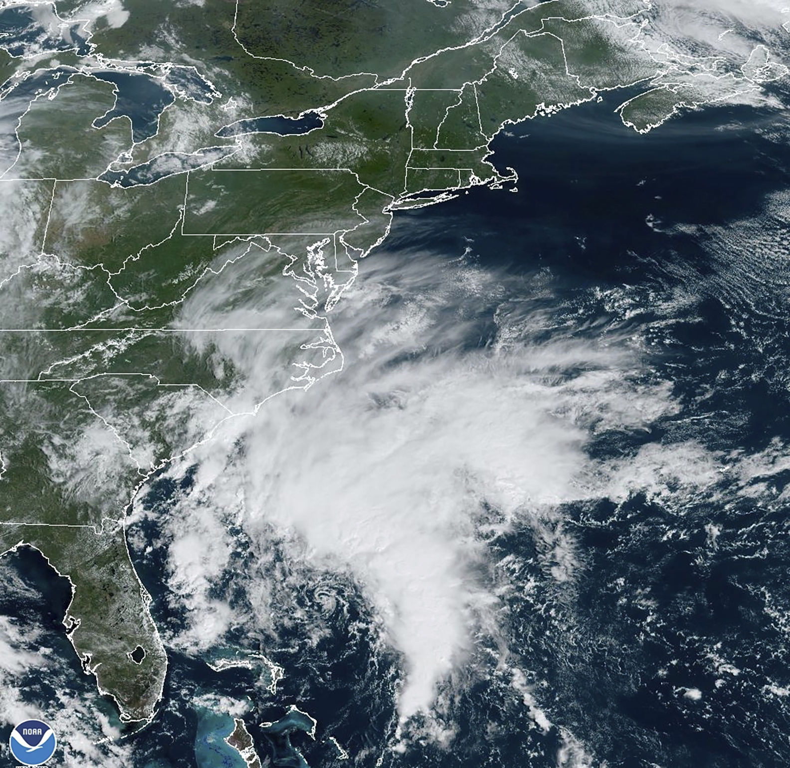
Tropical Storm Ophelia has made landfall near Emerald Isle in North Carolina, bringing gusty winds to the coast. Even as the storm continues to move inland, a lot of the sloppy and wet weather is dislocated well to the north.
As the center of the storm nears land early Saturday, Hurricane Hunters are investigating the storm’s center to investigate the storm’s approximate strength.
In either case of a high-end tropical storm, or low end hurricane, Ophelia has already brought downpours to the North Carolina coast, and strong waves along the Outer Banks and to the Mid-Atlantic coast.
Get New England news, weather forecasts and entertainment stories to your inbox. Sign up for NECN newsletters.
In New England, the cloudy skies start the day are indicative of Ophelia’s stretched structure and the rain we’ll likely encounter throughout Saturday. The day will be cool as clouds dim the sun, and a strong east wind persists much of the weekend.
This aids in bringing in cooler air from the Atlantic, and will keep temperatures about 10° below normal for the start of fall. Breezy winds across the Cape & Islands will read between 15 and 25mph through much of the day, with stronger tropical storm force gusts Saturday evening around 5 p.m.
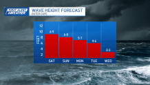
The Atlantic is churned up as rough surf ensues too. Wave heights are between 6 and 9 feet Saturday, and near 7 feet on Sunday. Rain will be heaviest across the South Coast starting around Noon, with scattered showers and drizzle starting in Boston around 2 p.m.
The rain will turn moderate around 5 p.m., before breaking at sunset. This will signal the passage of one feature of Ophelia. It will remain breezy through Saturday night, and Sunday morning, with the next round of showers through Sunday.
It doesn’t seem like the rainfall will be steady and heavy either day, in fact there’s a sharp cutoff along and north of the Mass Pike where air will be drier to the north. The same can’t be said for the south coast though, as streams of moisture plume through.
Because the rainfall will be spread out all weekend, and into Monday, flooding isn’t likely. Also working in our favor is the tide cycle. We aren’t at a full moon, so the water level rise won’t peak in an area of concern. After Ophelia clears the coast on Monday, drier skies and cooler crisp fall air should return for the middle of next week.