
A tornado warning that was issued for parts of northwestern Worcester County in central Massachusetts Friday afternoon has expired, but heavy rain and storms continue to move across New England.
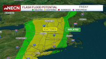
There were flash flood warnings and severe thunderstorm warnings in much of the region Friday night. Early Saturday morning, flash flood warnings remained in place in Massachusetts' Suffolk County, Norfolk County, Essex County and Middlesex County.
Click here for the latest weather alerts in your area.
Flooding was reported in Billerica Friday evening.
Get New England news, weather forecasts and entertainment stories to your inbox. Sign up for NECN newsletters.
In Boston, the Red Sox were playing the Mets before the game was suspended in the fourth inning. Videos from fans showed cascading water at Fenway Park.
Weather Stories
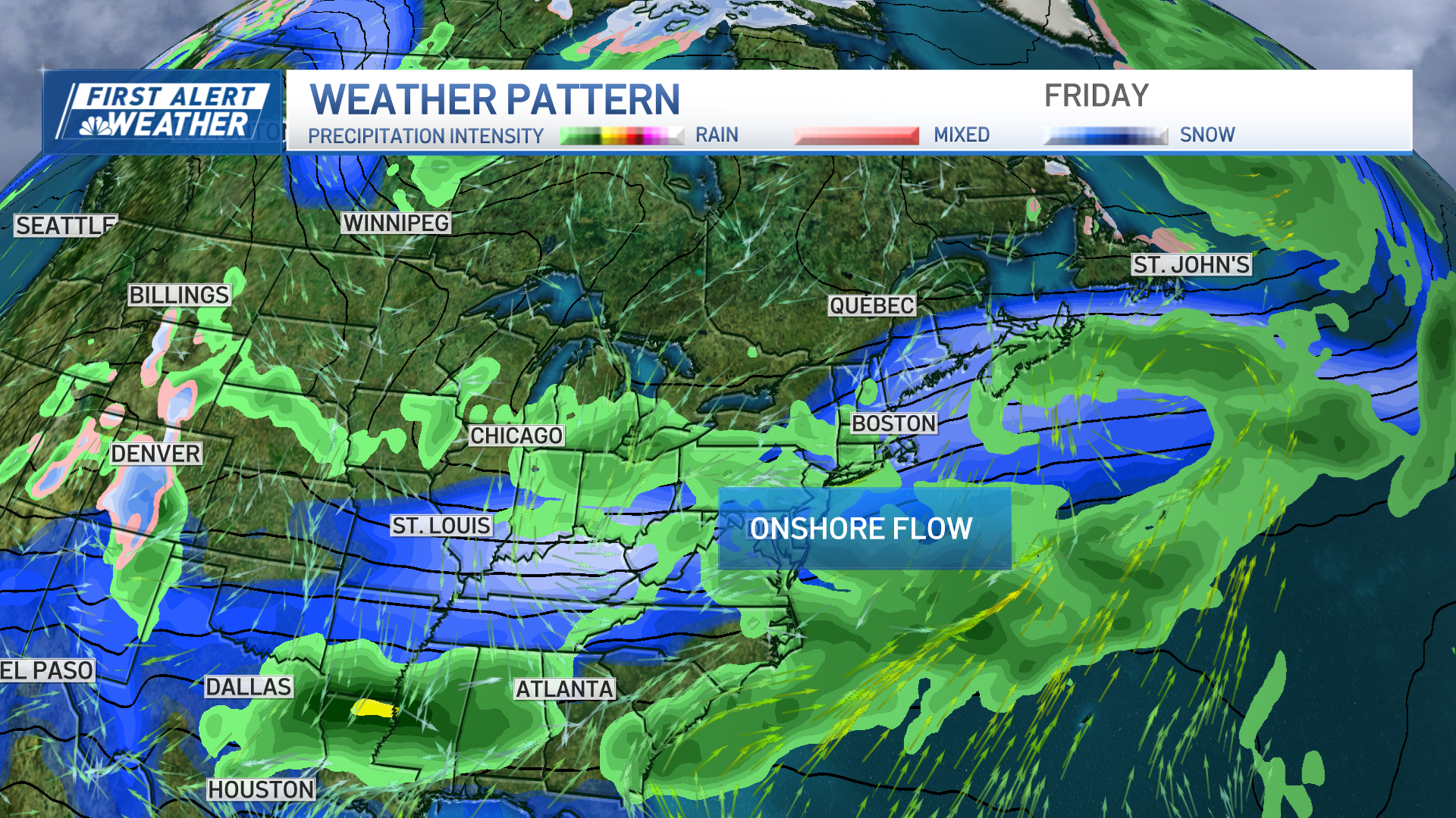
Vermont is under a Flash Flood Watch through Friday night, due to the heavy rainfall coming down over highly saturated ground. It may only take one inch in parts of northwestern Vermont to see flash flooding taking place in counties like Addison and Chittenden. Heavy rainfall, however, may still spread into New Hampshire and central Massachusetts, producing localized urban and street flooding.
Several roads have already been flooded out and are now closed in Deerfield and Greenfield in western Massachusetts.
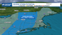
The strongest storms may provide the potential for damaging wind gusts, hail and, while the chance is low, there is an existent opportunity for some rotation along the far western parts of New England — including Massachusetts, Connecticut and into southwestern New Hampshire and southern Vermont.
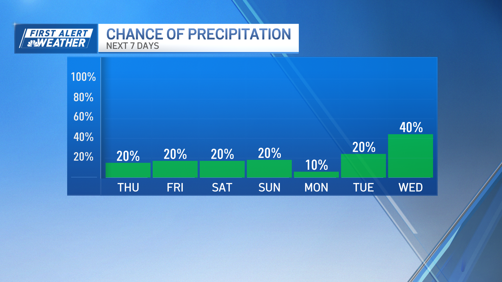
As for timing these storms, they may last through 10 to 11 p.m. Friday night, although by the end of this event, as they spread east, their strength will begin to wind down. Lingering scattered showers may remain across far southeastern Massachusetts late Friday night and into Saturday morning with calm conditions through the weekend.
Temperatures rebound to the low 80s Saturday, with highs in the mid-80s by Sunday. While variable clouds and a shower or two remains on tap for Saturday, it will still be a nice weekend overall to be out and about.
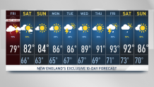
Sunshine will increase in coverage Sunday, with brighter skies and dry air in place. Temperatures are likely to increase even more by Monday with readings in the upper 80s becoming more numerous. The next chance for rain and storms will roll through on Tuesday, although the coverage of this round doesn’t appear to be widespread as it takes up western and northwestern New England mostly.
The heat will stay in place through the end of the work week with temperatures that near or reach 90 degrees around midweek onward.
