
We had another crisp, cool morning and high temperatures Wednesday will be a tad cooler than normal once again.
Highs in the mid to upper 30s are a touch below average highs for this time of the year (40 for Boston). A few clouds move in from the southeast as the day goes by.
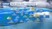
As the clouds stick around Wednesday night, our temps won't be allowed to cool quite as much, but will still be frosty in the 20s. Highs Thursday will be a couple degrees milder as our quick warm up kicks in, in the 40s. More clouds roll in ahead of our next storm system.
Get New England news, weather forecasts and entertainment stories to your inbox. Sign up for NECN newsletters.
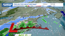
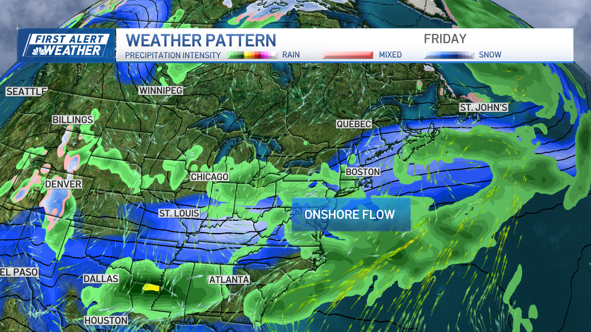
A light wintry mix moves in around 11p.m. Thursday night ahead of a warm front. Through morning, we see a mix and even snow in the higher terrain areas.
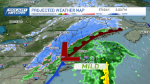
Then, southern New England flips to all rain, eventually even the Berkshires and Worcester Hills flip to rain late Friday. The northern Berkshires, Green, and White mountains should remain all snow.
Accumulation will be coatings to 2 inches in the Worcester Hills to Berkshire with a lot of it getting washed away by rain. 1 to 2 inches of snow is forecast for northern New England and interior Maine to interior New Hampshire (rain at the coast), with 2 to 4 inches of snow in the highest peaks.
The storm system moves out by early Saturday morning, with a cold northwest wind and clear skies. Highs drop to the low 30s Saturday, with upper 30s Sunday.
Both days will be sunny, at least. Next week will begin to feel like spring. Highs reach the 50s and may even push 60 in southern New England by midweek.
Weather Stories
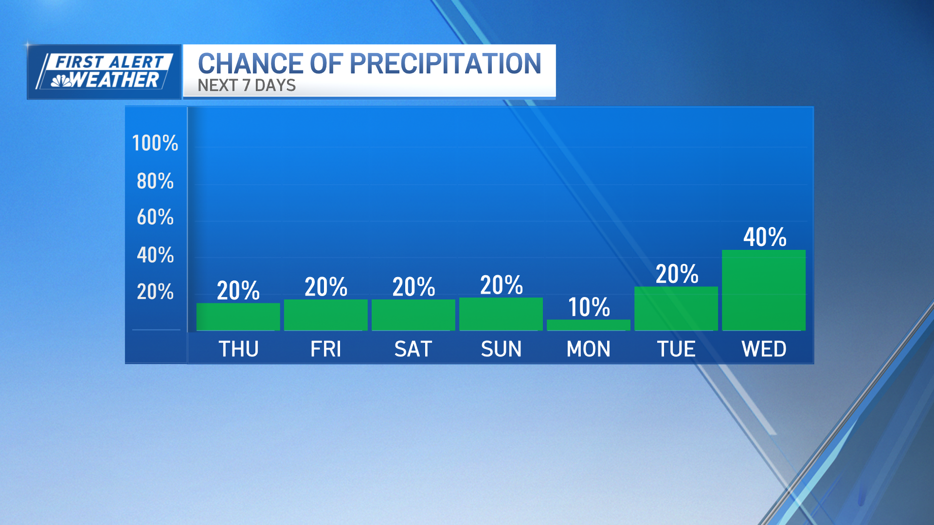
With the warmth comes a chance for scattered rain starting on Monday and lasting through Thursday.
