The Latest
-
Warm Weekend Continues With Mostly Sun, Spot Showers
We had the best morning of the year so far! It was crisp, mostly sunny and simply perfect. Just like Friday and the day prior, the sun will warm things up quickly and building clouds are expected Saturday afternoon with scattered showers in Maine and a sprinkle in Southern New England, while it’s mainly rain-free elsewhere. Highs Saturday will...
-
Gloomy Week Ahead, With Showers on the Way
Our highs today were reached before 5 a.m. this morning in Boston. The temperature around then dropped from 58 to 49 degrees thanks to a back door cold front, which came in from Maine and slid to the southwest. Clouds, fog and drizzle will be the main theme Sunday and Monday. A warm front to our southwest will reinforce the…
-
Cold Front Arrives in New England, Heavier Wind Gusts Sunday
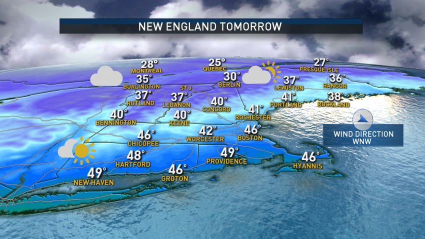
The wind will continue to ease Saturday afternoon as high pressure quickly builds over the region, with gusts up to 30 mph possible at times under a mainly sunny sky. The exception will be the mountains, where clouds develop and a few flurries are possible. Highs will reach into the 30s north, with 40s to around 50 degrees south. Saturday…
-
Winter Walks Out, Major Warm-Up Headed Our Way
We have one last day of winter weather before temperatures rise next week. Highs Sunday will be in the 20s north to 30s south under plentiful sunshine though a few clouds are possible this afternoon. A strong sun angle this time of the year means that we could easily get a sunburn so make sure to apply sunscreen — perfect…
-
Rainy Skies Close the Weekend, With Freezing Rain and Snow Combo North
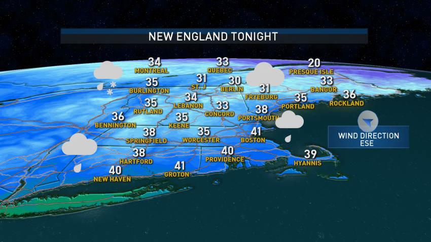
If you blinked, you missed it. We woke up to a few rays on sunshine Sunday morning north of the Bay State, but now clouds have taken over and will continue to expand north and east due to our next disturbance, which arrives late day. At least we end February with temperatures in the 40s with a few spots in…
-
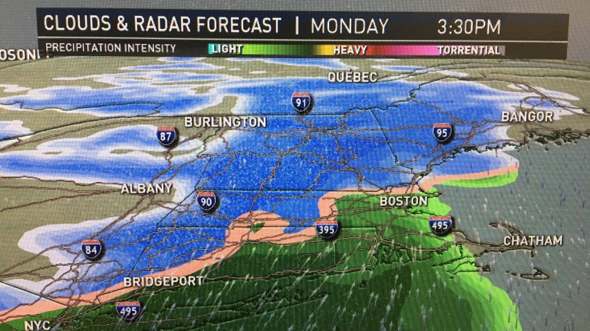
Storm Sweeps New England Monday, Dropping Snow West and North, Rain Elsewhere
The sun has returned for much of the region — except Cape Cod — to close out the weekend. Ocean-effect snow showers continue to impact the outer Cape due to a northwest wind. Elsewhere, Sunday is bright but chilly with highs in the low 30s. Light wind will settle across the area as a dome of high pressure takes control…
-
Spotty Rain Continues Across New England
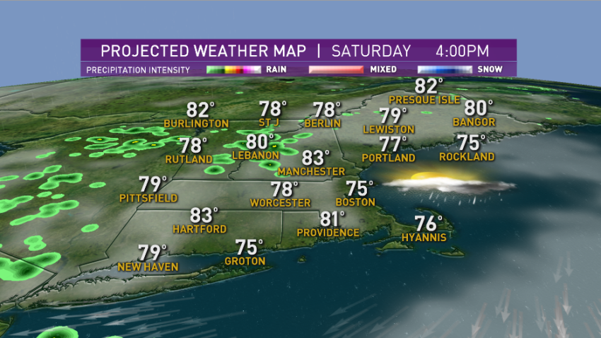
This morning we had a decent cluster of rain and storms over southern Vermont that dropped close to 2 inches of rain but elsewhere, it was spotty in nature and barely picked up some much-needed water for the lawn.
-
Temps Climb in the 90s, Heat Wave to Peak on Monday
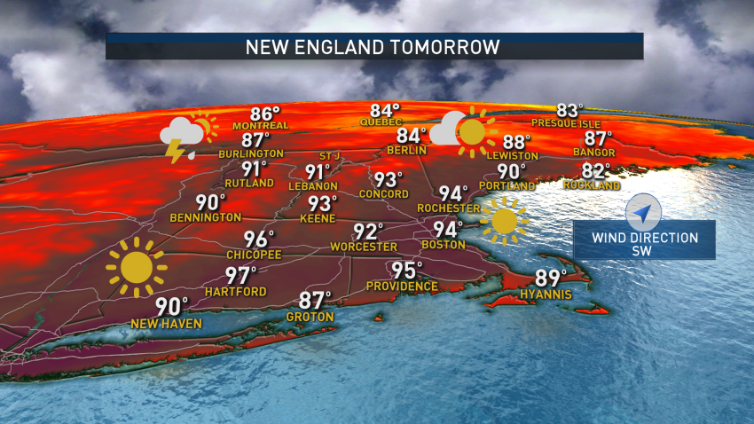
A Sunday filled with sunshine and with a wind out of the southwest, temperatures are climbing quickly. While yesterday a few spots made it to 90 degrees, today most locations will begin their heat wave with highs soaring past 90 degrees. Even the beaches, except for the south facing coast, will be around 90 degrees. If you are not a…
-
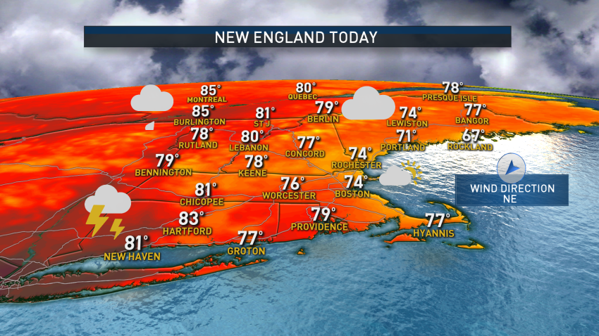
Severe Thunderstorms Possible Again Friday
This morning, we have a mostly cloudy sky with cooler temperatures in Maine though it’s still muggy in southern New England. A back-door cold front will continue to slide south, and that will change our weather drastically as cooler air pushes in from the northeast, dropping our temperatures into the 70s along the coast, 80s inland.
-

Boston Logs 1st 90-Degree Day of 2020 as Heat Wave, T-storms Impact Region
The weekend will feature more 90s and humid conditions with a slight chance for a shower or isolated thunderstorm across Western and Northern New England. Click here for the latest weather alerts Today also features the third consecutive day of 90-degree-plus temperatures in the Merrimack Valley, Southern New Hampshire, Champlain Valley and Northern Maine, which officially makes it a heat…

